

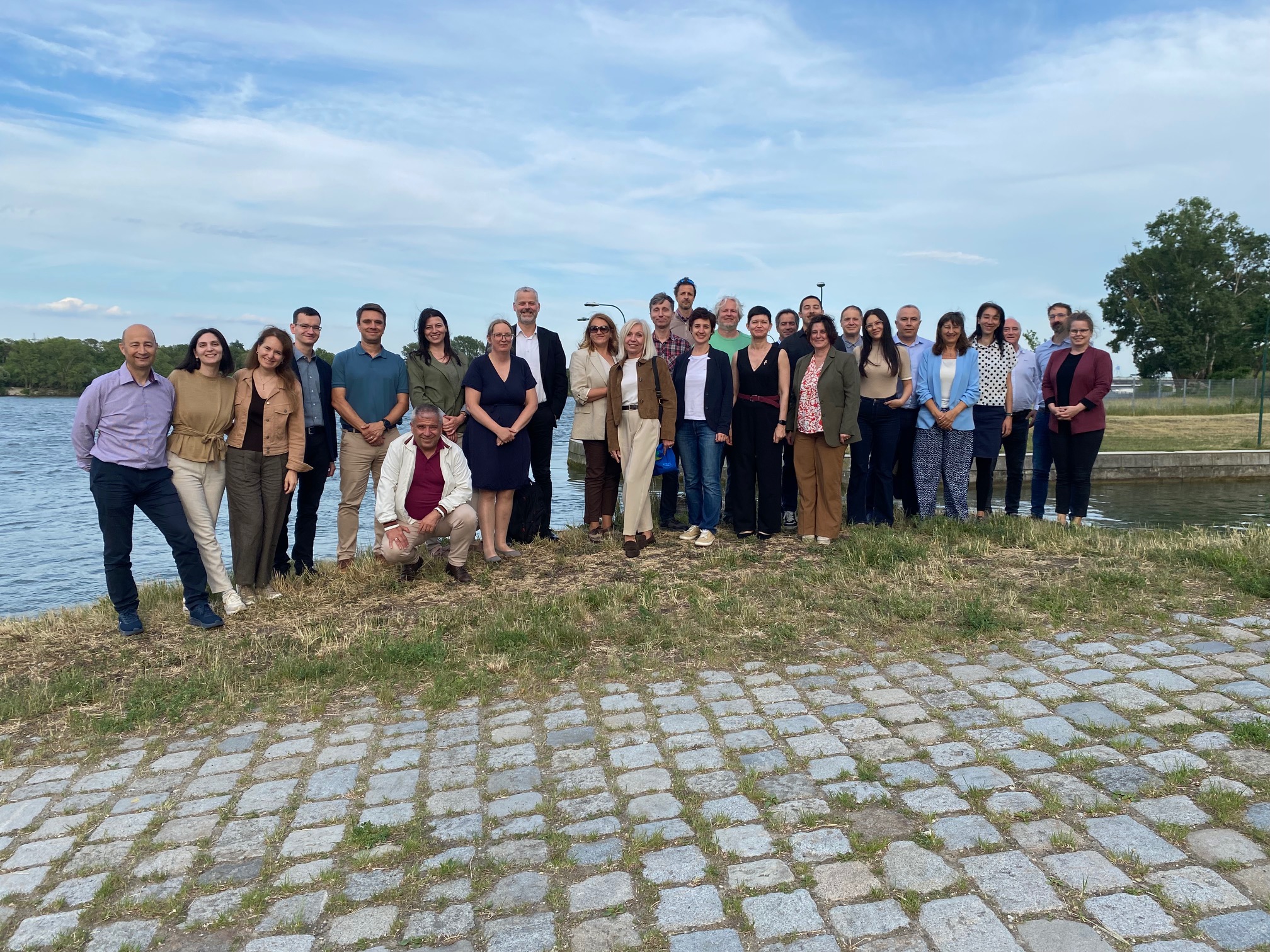
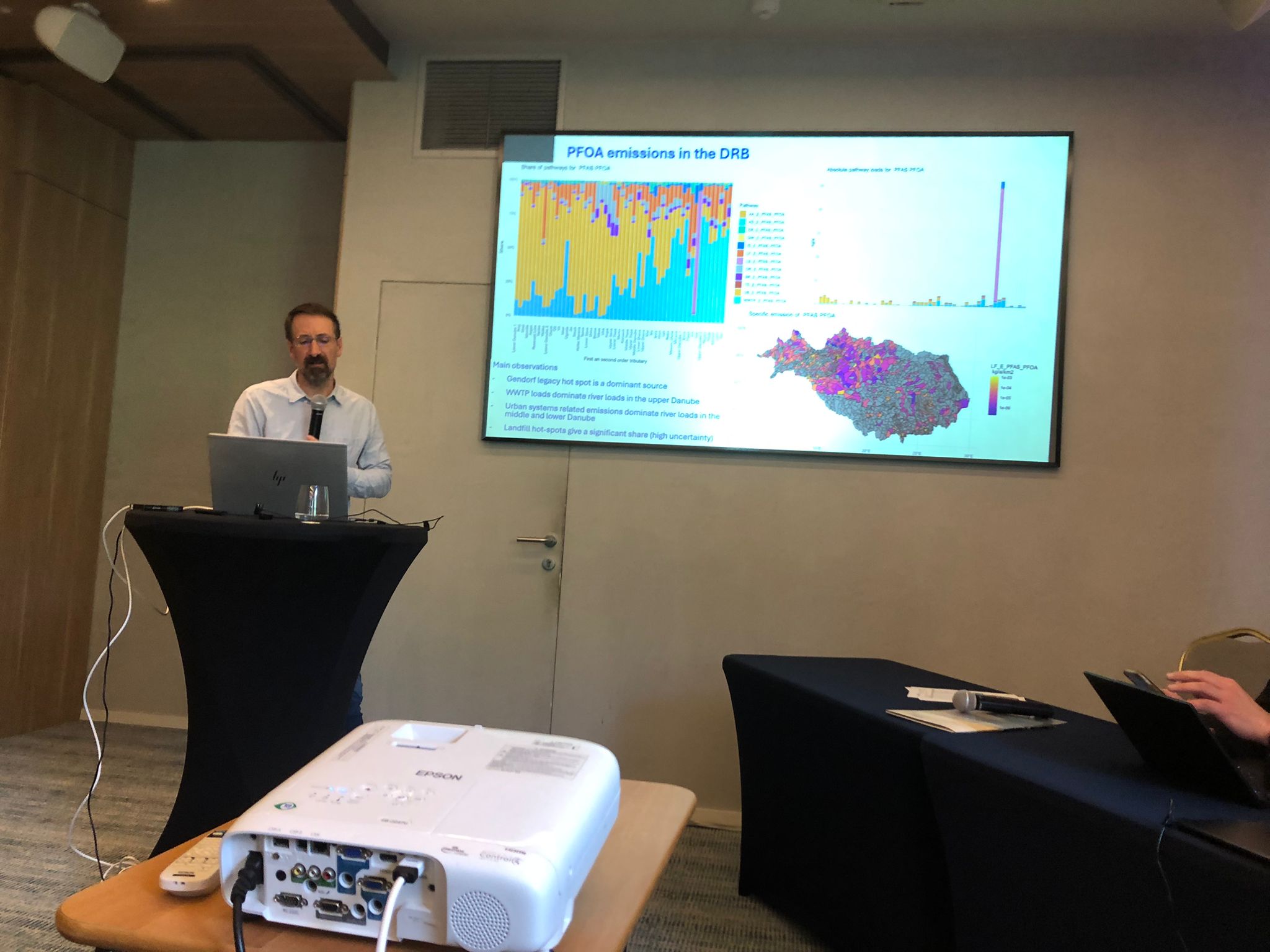
Introducing PET at the Tehys International Workshop
One of the focus points of the Tethys International Workshop was the presentation of PET - the Pollution Evaluation Tool, developed in the frame of the project.
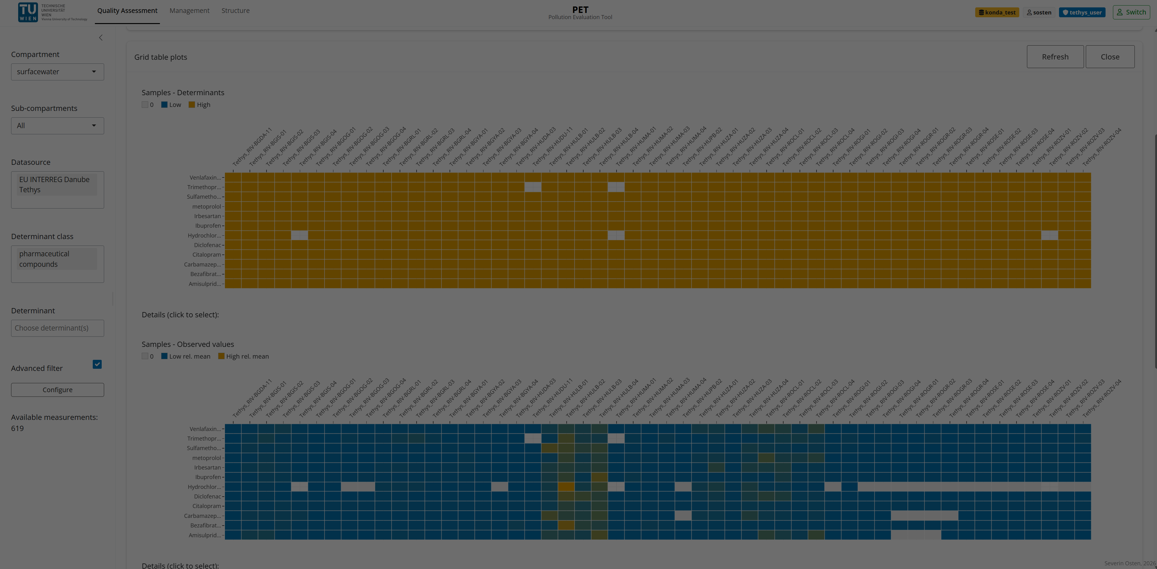
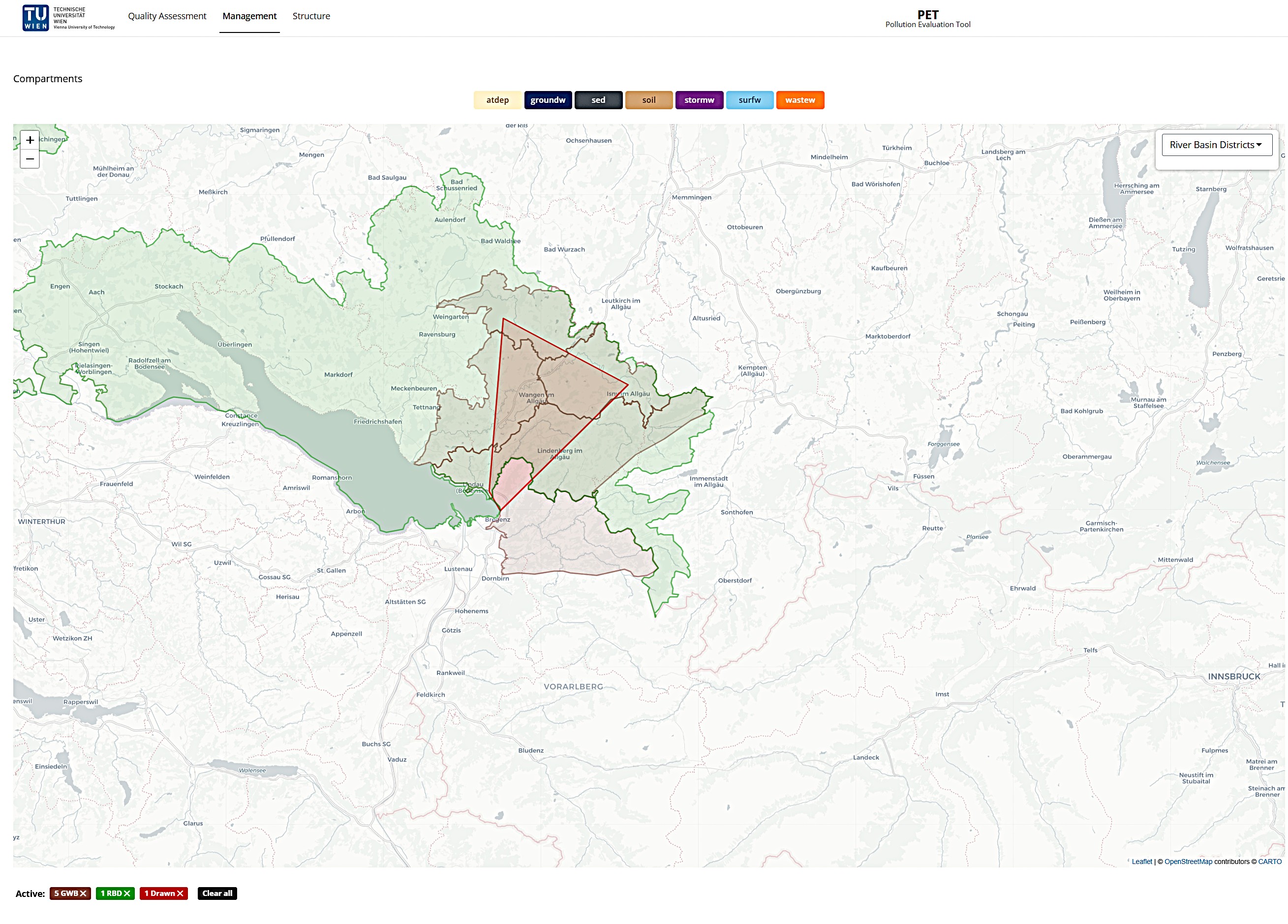
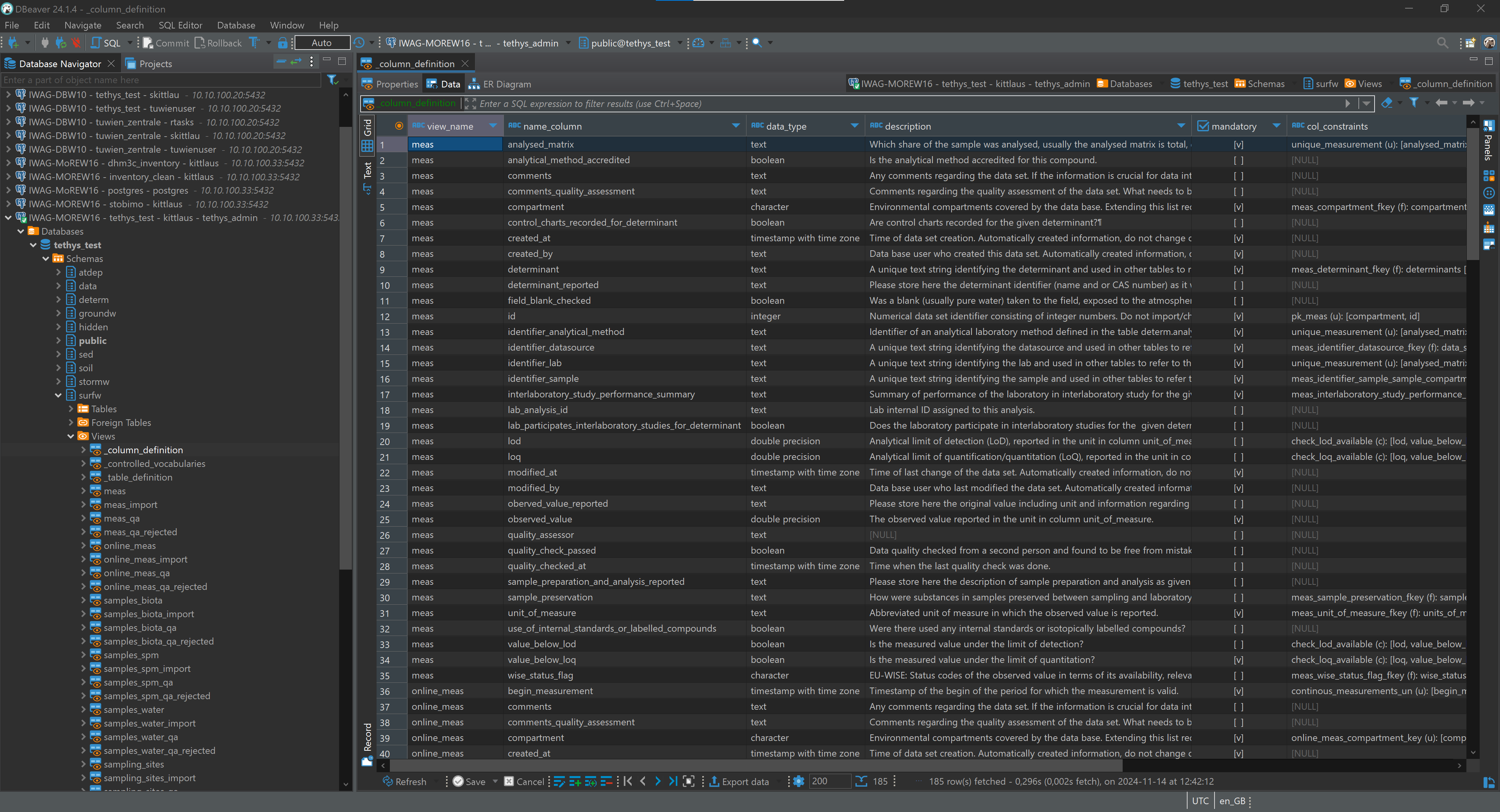
PET is an interactive data management and analysis platform for environmental monitoring data, built on a PostgreSQL/PostGIS database. The application provides a centralized environment for managing, spatially filtering, and quality-assessing measurement data across multiple environmental compartments — including surface water, groundwater, sediment, soil, and wastewater.
Its core strength lies in the seamless integration of spatial and analytical workflows: users can filter measurement data directly against EU regulatory geodata (WFD water bodies, NUTS regions), draw custom polygons, or upload shapefiles — instantly obtaining an overview of measurement density, determinant coverage, and data completeness. A built-in Quality Assessment workflow ensures that data are systematically reviewed, validated, and annotated with standardised status flags.
By coupling directly with European environmental standards (WFD 2022, EQS) and controlled vocabularies, PET guarantees not only data quality but also interoperability — providing a robust foundation for scientific analysis, regulatory reporting, and the dissemination of monitoring data to third parties.

27/05/2026
By
Share on social media:


News & Events
Read the most recent updates and explore the upcoming events.


Would you like to receive project updates?
You're already part of our community!
Welcome to our newsletter community!
Subscribe to our newsletter