

Online mapping tool workshop
SpongeCiy project organised an online workshop for municipal experts and urban planners on 30 Apr. The workshop focused on the development of an online toolbox designed to assist municipalities in rainwater harvesting initiatives. Lin Nyi Nyi Nyan (PLUS) presented the toolbox's current stable version, detailing its functionalities shaped by user feedback from previous sessions. He outlined the timeline for future developments, including an alpha version by June, a beta version by September, and a public release planned for late 2025, while encouraging user feedback to refine the toolbox further.
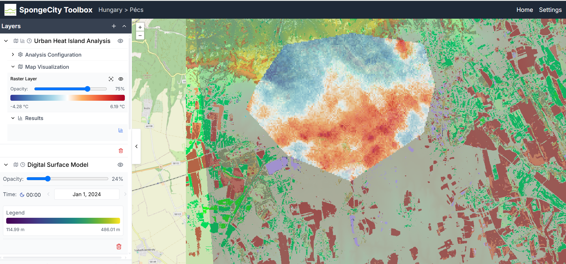
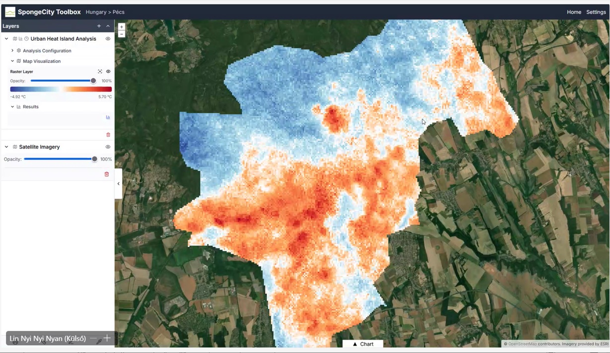
PLUS provided an overview of the toolbox dashboard, which serves as a web GIS interface for data visualization and analysis. The dashboard allows users to visualize maps, data layers, and statistical graphs, all processed client-side for a streamlined experience. It currently includes land surface coverage, greenness, and surface temperature data, with ongoing efforts to enhance datasets and functions. Lin also demonstrated how to integrate map layers, including satellite imagery.
The analysis functions of the toolbox were highlighted, showcasing simplified options for assessing urban heat islands and vegetation greenness. Users can define parameters and select analysis areas, revealing temperature differences and vegetation stability over time. Lin introduced a classification system for vegetation types and the session concluded with a demonstration of the toolbox's features, including layer arrangement and map exporting, while participants provided feedback on user testing and the need for metadata and guidelines to enhance usability.

30/04/2025
By Mónika Kovács
Share on social media:


Cooperation

News & Events
Read the most recent updates and explore the upcoming events.


Would you like to receive project updates?
You're already part of our community!
Welcome to our newsletter community!
Subscribe to our newsletter