Sampling campaign in Serbia
SURFACE WATER SAMPLING PROFILES
The Bezdan site, located on the Danube River at coordinates 45.863976, 18.848899 with a catchment area of 210250 km², falls under the EU-WFD water body ID RSD_10 identified as 'Danube from the mouth of the Drava to the state border with Hungary'. Classified as a validation site, this location serves as a border profile on the border with Hungary. Expected sources of pollution include industries located upstream in Hungary.
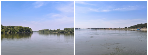
The Zemun site, located on the Danube River at coordinates 44.8496854, 20.411275 with a catchment area of 412762 km², falls under the EU-WFD water body ID RSD_06 identified as 'Danube from the mouth of the Sava to the mouth of the Tisa.'. Classified as a validation site, this location serves as a sampling profile immediately upstream of the confluence of the Sava and Danube rivers. The sampling profile is impacted by a population of approximately 250,000 inhabitants. Expected sources of pollution include Industries such as: metal industry, chemical industry, pharmaceutical industry, wood industry, textile industry, construction industry, food industry, agriculture.
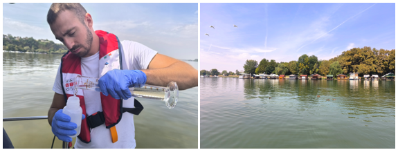
The Ritopek site, located on the Danube River at coordinates 44.693655, 20.959220 with a catchment area of 525820 km², falls under the EU-WFD water body ID RSD_05 identified as 'Reservoir of the Đerdap 1 Hydroelectric Power Plant from the mouth of the Velika Morava to the mouth of the Sava'. Classified as a validation site, this location serves as a sampling profile some 4 km downstream of the Vinča landfill. The sampling profile is impacted by the City of Belgrade located upstream with its 2 million inhabitants as well as the municipal waste landfill Vinča and agricultural activities. Expected sources of pollution include the village of Ritopek with approximately 2500 inhabitants and predominantly agricultural activities focused on the production of fruits.
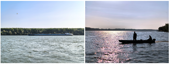
The Banatska Palanka site, located on the Danube River at coordinates 44.826118, 21.339775 with a catchment area of 568648 km², falls under the EU-WFD water body ID RSD_04 identified as 'Reservoir of the Đerdap 1 Hydroelectric Power Plant from the mouth of the Nera to the mouth of the Velika Morava.'. Classified as a validation site, this location serves as a border profile on the border with romania. the danube river forms a natural border here. . There are no expected sources of pollution.
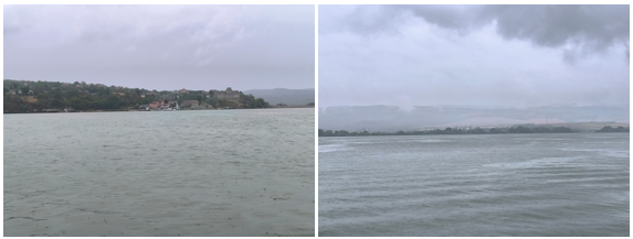
The Radujevac site, located on the Danube River at coordinates 44.262762, 22.680365 with a catchment area of 577085 km², falls under the EU-WFD water body ID RSD_01 identified as “Danube downstream of the Iron Gate 2 HPP to the confluence of the Timok”. Classified as a validation site, this location serves as a border profile on the border with Romania. the Danube river forms a natural border here. The sampling profile is located downstream of the Iron gate II dam. Expected sources of pollution include the IHP Prahovo Chemical complex located approximately 8km upstream which produces approximately 300,000 tons of NPK fertilizer annually.
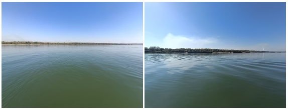
The Titel site, located on the Tisa River at coordinates 45.197991, 20.312873 with a catchment area of 157174 km², falls under the EU-WFD water body ID RSTIS_1 identified as 'Tisa from the confluence with the Danube to the confluence with the Jegrička.'. Classified as a validation site, this location serves as a sampling profile on the Tisza river near Titel, some 8 km upstream of the confluence of the Tisza and Danube rivers impacted by some 13000 inhabitants within the municipality of Titel. Expected sources of pollution include agricultural and livestock farming activities and wood packaging manufacture.
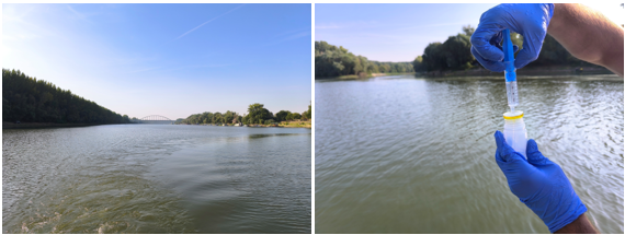
The Jamena site, located on the Sava River at coordinates 44.878084, 19.084062 with a catchment area of 64073 km², falls under the EU-WFD water body ID RSSA_7 identified as Sava from the mouth of the Drina to the state border with the Republic of Croatia . Classified as a validation site, this location serves as a border profile on the border with Croatia. There are no expected sources of pollution.
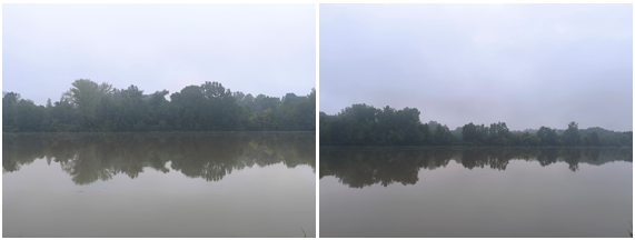
The Novi Beograd site, located on the Sava River at coordinates 44.796356, 20.409996 with a catchment area of 95719 km², falls under the EU-WFD water body ID RSSA_1 identified as 'Sava from the confluence with the Danube to the confluence with the Kolubara.'. Classified as a validation site, this location serves as a sampling profile on the Sava river immediately upstream of the confluence with the Danube river impacted by the city of Belgrade with its 2 million inhabitants as well as several industries. Expected sources of pollution include industries including: thermal power plant, dairy industry, hygeine and cosmetic industry, wood industry, textile industry, construction industry, food industry, different craft businesses, alcoholic beverage industry.
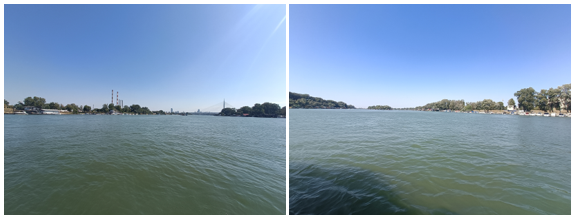
The Badovinci site, located on the Drina River at coordinates 44.776794, 19.342564 with a catchment area of 19350 km², falls under the EU-WFD water body ID RSDR_1_A identified as 'Drina from the confluence with the Sava to the confluence with the Lešnica.'. Classified as a validation site, this location serves as a border profile on the border with Bosnia and Herzegovina. There are no expected sources of pollution.
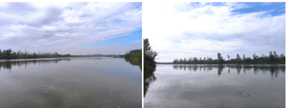
The Ljubičevski most site, located on the Velika Morava River at coordinates 44.585584, 21.132454 with a catchment area of 37320 km², falls under the EU-WFD water body ID RSVMOR_2_A identified as 'Velika Morava from the Ljubičevo Bridge to the confluence with the Jasenica.'. Classified as a validation site, this location serves as a sampling profile on the great morava river located some 5km southwest of the city of Požarevac and 22 km upstream of the confluence of the great morava into the danube. affected mainly by agricultural activities. There are no expected sources of pollution.
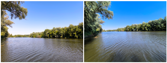
The Maskare site, located on the Zapadna Morava River at coordinates 43.672081, 21.396393 with a catchment area of 14721 km², falls under the EU-WFD water body ID RSZMOR_1_A identified as 'West Morava from the confluence with the South Morava to the confluence with the Pepeljuša'. Classified as a validation site, this location serves as a sampling profile on the west Morava, impacted mainly by agricultural activities in the catchment and the city of Kruševac with it's 58,000 inhabitants. It is impacted by chemical industrial activities, agricultural activities, metal works.
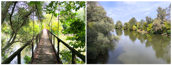
The Mojsinje site, located on the Južna Morava River at coordinates 43.630735, 21.485346 with a catchment area of 15390 km², falls under the EU-WFD water body ID RSJMOR_1 identified as 'Morava from the confluence with the West Morava to the confluence with the Ribar River.'. Classified as a validation site, Mojsinje is located within the city of Čačak which has a population of approximately 69,000 inhabitants. Expected sources of pollution from industries such as metal works, production of home appliances, production of tools, chemical industry.
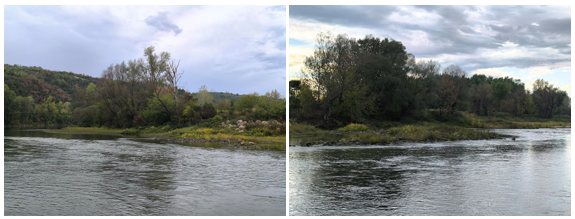
The Batrage site, located on the Ibar River at coordinates 43.297226, 20.614529 with a catchment area of 810 km², falls under the EU-WFD water body ID RSIB_6 identified as 'Ibar upstream from the Gazivode reservoir to the state border.'. Classified as a validation site, this location serves as a sampling profile on the Ibar river prior to it's inflow into Kosovo. There are no expected sources of pollution.
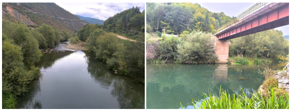
The Kraljevo site, located on the Ibar River at coordinates 43.718491, 20.688838 with a catchment area of 7925 km², falls under the EU-WFD water body ID RSIB_1 identified as 'Ibar from the confluence with the West Morava to Mataruge'. Classified as a validation site, this location serves as a sampling profile on the Ibar near Kraljevo which has a population of 67,000 inhabitants. Affected by various industries including: food production, textile industry, leather industry, wood industry, rubber and plastic goods production, metal works, furniture production.
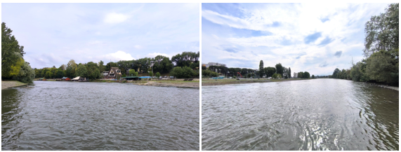
The Rajac site, located on the Timok River at coordinates 44.104004, 22.570519 with a catchment area of 4180 km², falls under the EU-WFD water body ID RSTIM_3 identified as 'Tabakovačka Gorge to the confluence with the Borska River'. Classified as a validation site, this location serves as a border profile on the border with Bulgaria. Expected sources of pollution include agricultural and fruit production activities.
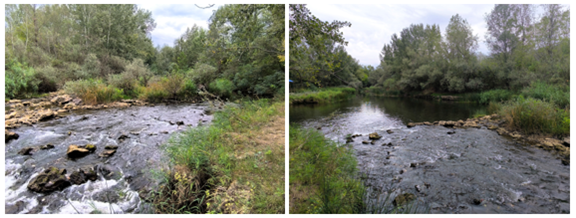
The Rgotina site, located on the Borska reka River at coordinates 44.008914, 22.275337 with a catchment area of 320 km², falls under the EU-WFD water body ID RSBELK_1 identified as 'Borska River from the confluence with the Crni Timok to the confluence with the Krivelj River.'. Classified as a hot-spot site, this location serves as a sampling profile impacted by intense gold and copper mining activities and accompanying industries as well as the city of Bor with it's 48,000 inhabitants. . Expected sources of pollution include the Bor mining complex.
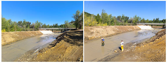
The Galovica site, located on the Galovica River at coordinates 44.7698936, 20.3422073 with a catchment area of 750 km², falls under the EU-WFD water body ID RSCAN_GLVC_1 identified as 'Galovica from the confluence with the Sava to the confluence with the Veliki Begej.'. Classified as a hot-spot site, this location serves as a sampling profile locatede near the Belgrade international airport and the E-75 motorway. Expected sources of pollution include Belgrade International airport, E-75 motorway and agricultural activities.
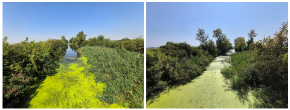
The Draževac site, located on the Kolubara River at coordinates 44.5802771, 20.2076678 with a catchment area of 3588 km², falls under the EU-WFD water body ID RSKOL_1 identified as 'Kolubara from the confluence with the Sava to the confluence with the Tamnava.'. Classified as a validation site, this location serves as a sampling profile on the Kolubara river. Expected sources of pollution include upstream industries from the Kolubara power plant.
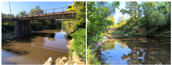
The Braničevo site, located on the Pek River at coordinates 44.7179, 21.534788 with a catchment area of 1180 km², falls under the EU-WFD water body ID RSPEK_1 identified as 'Pek in the backwater zone from the reservoir of the Đerdap 1 Hydroelectric Power Plant (km 2+500). Classified as a hot-spot site, this location serves as a sampling profile impacted by intense mining activities. Expected sources of pollution include Majdanpek mining complex.
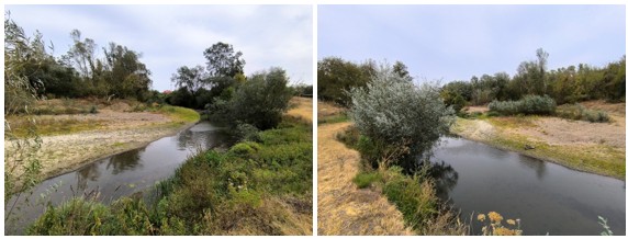
GROUNDWATER SAMPLING SITES
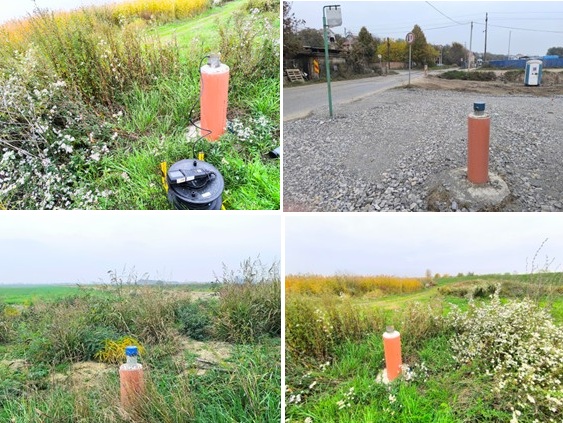
Sampling sites PA located at coordinates 44.783696, 20.263555, PB located at coordinates 44.785926, 20.325954, PC located at coordinates 44.7739871, 20.3144564 and PD located at coordinates 44.793204, 20.305913, near Belgrade International Airport, are all piezometers located in the EU-WFD Ground water body East Srem Upper most aquifer. All four sampling sites are classified as hot-spots and they are all impacted by the Belgrade International Airport, the E-75 motorway as well as agricultural activities in the area.
WASTEWATER SAMPLING PROFILES
6 wastewater sites were sampled with 3 wastewater treatment plant discharges, 2 untreated wastewater discharges and one industrial wastewater discharge from a cardboard factory.
WWTP Šabac, located at coordinates 44.745397, 19.7269516, with ID of WWTP in the UWWTD report RSKSAB01, is a discharge of treated municipal wastewater with a constructed capacity of approximately 84000. The receiving water body is the Sava river. The WWTP receives discharges from households and industry (Municipal-industrial WWTP with 126 000 PU. It is impacted by the population of approximately 55,000 inhabitants and industrial activities such as: ceramic tile production, chemical production, food industry (milk and milk product production) and vehicle part production.

WWTP Subotica, located at coordinates 46.082323, 19.697755, with ID of WWTP in the UWWTD report RSKSUB01, is a discharge of treated municipal wastewater with a constructed capacity of approximately 150000. The receiving water body is the Palić lake . The WWTP receives discharges from households and industry (Municipal-industrial WWTP with 150 000 PU. It is impacted by the population of approximately 120 000 inhabitants and industrial activities such as: electrical wiring and machine production, printing industry, rubber and tyre production.
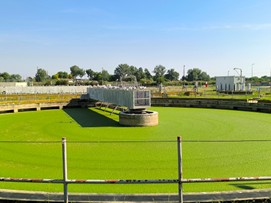
WWTP Kruševac, located at coordinates 43.6114155, 21.3323596, with ID of WWTP in the UWWTD report RSKKRU03, is a discharge of treated municipal wastewater with a constructed capacity of approximately 90000. The receiving water body is the West Morava. The WWTP receives discharges from households and industry (Municipal-industrial WWTP with 90 000 PU. It is impacted by the population of approximately 55,000 inhabitants and industrial activities such as: metal industry, chemical production, rubber industry, food industry.
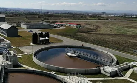
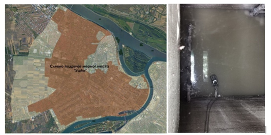
The untreated wastewater discharge Belgrade-Ušće, located at coordinates 44.822839, 20.442301, is a municiapl wastewater discharge into the Sava river. The drainage area of the discharge can be seen in the picture below.
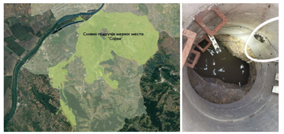
The untreated wastewater discharge Belgrade-Sajam, located at coordinates 44.797058, 20.433551, is a municiapl wastewater discharge into the Sava river. The drainage area of the discharge can be seen in the picture below.
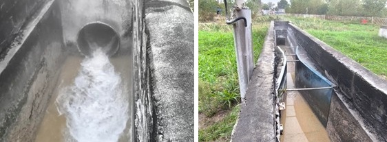
The Umka sampling site is an industrial wastewater discharge from a cardboard factory located near Belgrade. It is the outlet of wastewaters from the technological processes of cardboard production.
News & Events
Read the most recent updates and explore the upcoming events.

