


Germany
Incoretex GmbH
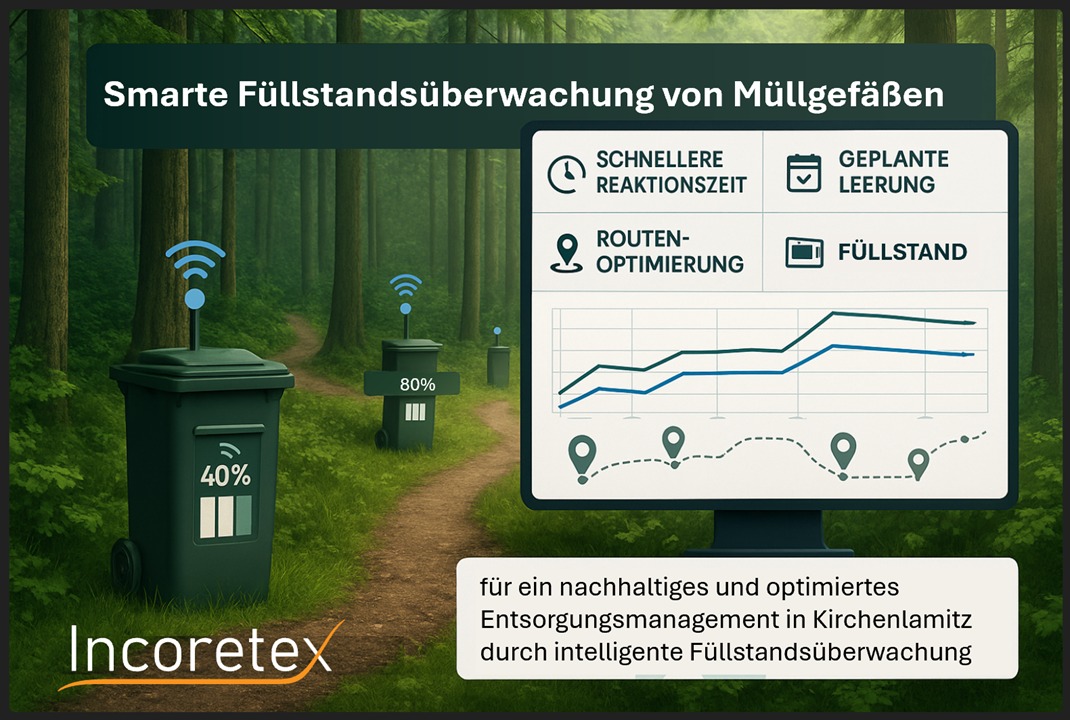
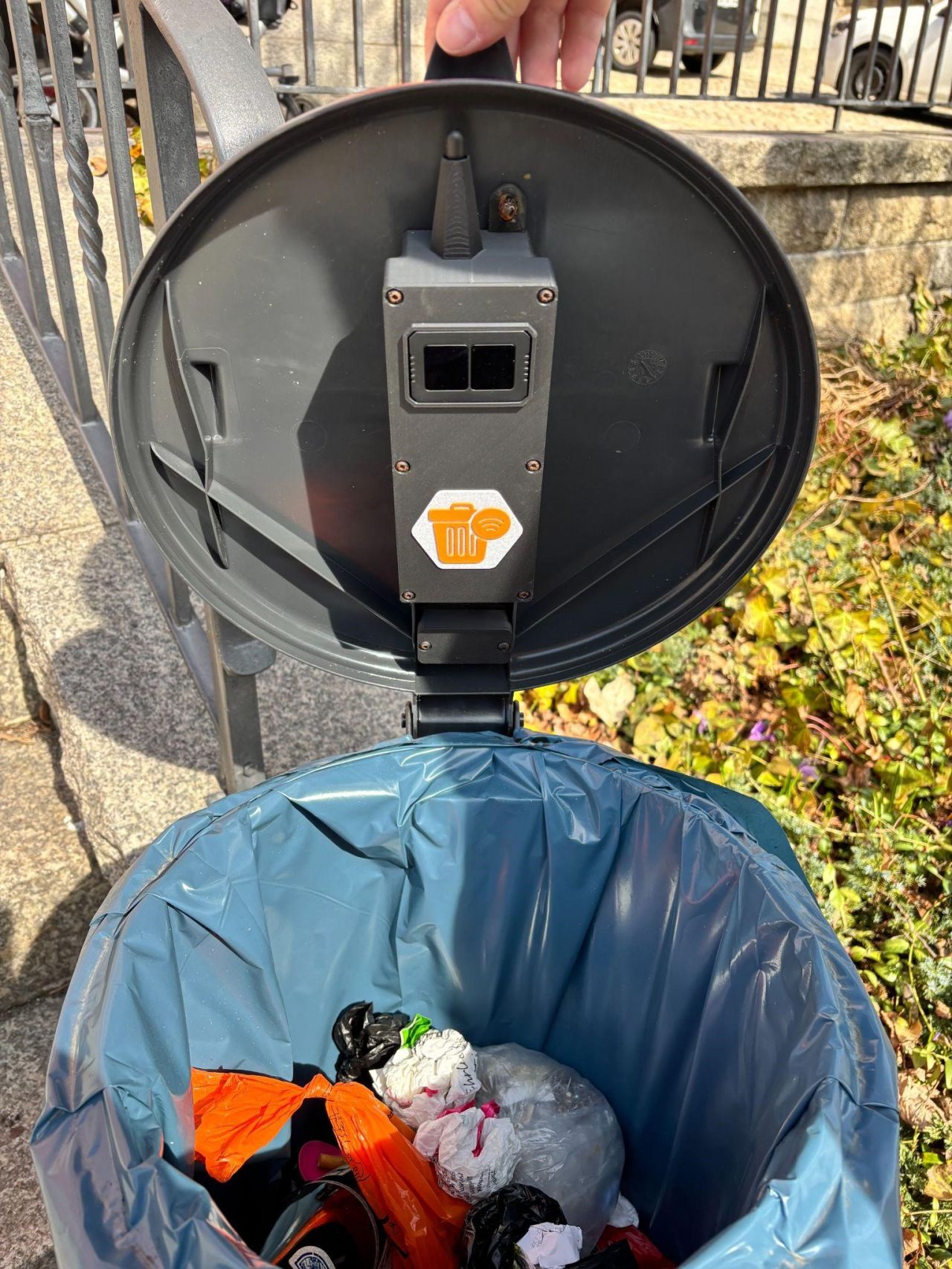
Building on Incoretex's AIOT infrastructure and the specific needs of Wunsiedel, this project aims to test and validate FÜB – a sensor-based, autonomous system for monitoring the fill levels of public waste bins. The proof-of-concept consists of the FÜB Sensor (In-Bin Unit) and the FÜB Connector.
The FÜB Sensor is installed inside waste bins to monitor fill levels without interfering with the filling or emptying process. The FÜB Connector manages system control, data evaluation, and transmission (e.g., via LoRaWAN or LPWAN) to the cloud. Data is visualized through a dashboard with an open API.
Implementation is based on Incoretex's established AIOT infrastructure, which has already been deployed in over 25,000 devices for clients such as Deichmann, Deutsche Bahn, and Kettler. This technology has also been recognized with awards like the NRW Start-up Prize.
The proven solution will be tailored to Wunsiedel's specific requirements and validated in real-world conditions.
Piloting city / location: Kirchenlamitz
https://incoretex.de/
Ideenkultivierung GmbH
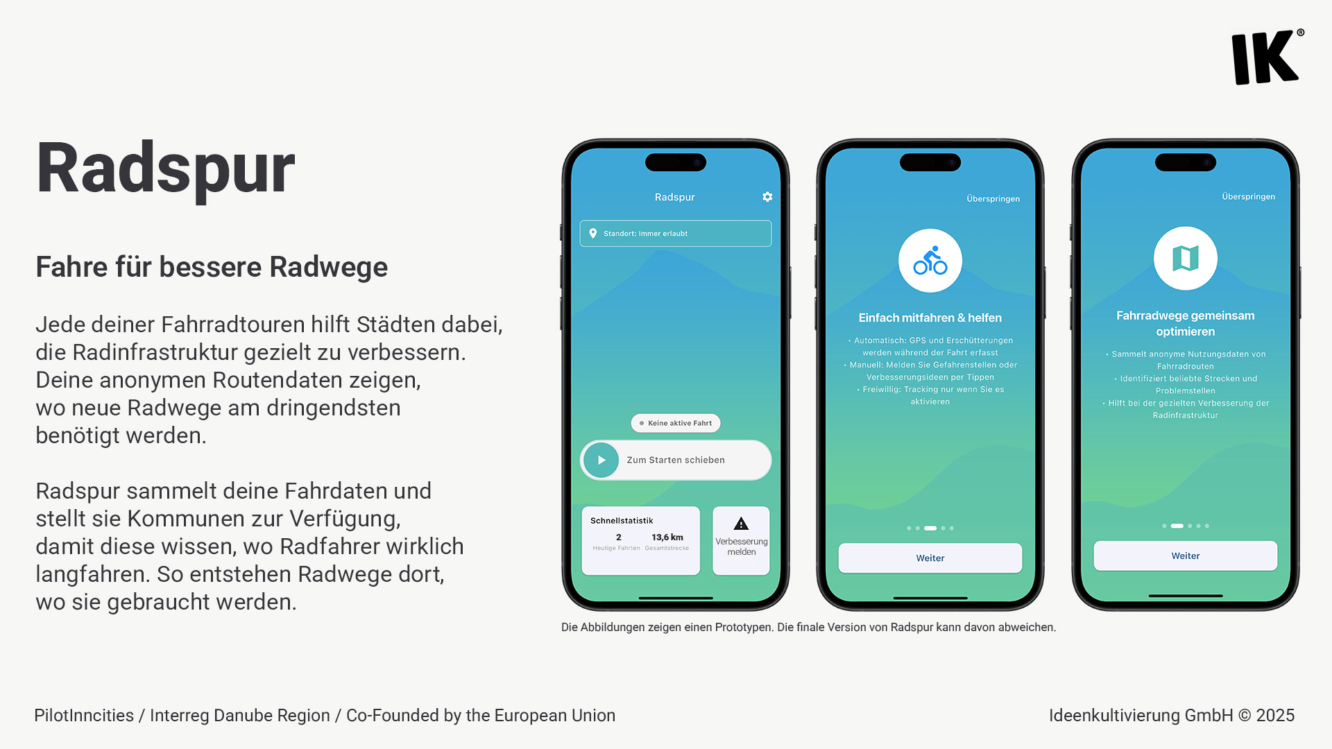
Our solution is based on low-threshold, app-based participation: volunteers use their smartphones to collect movement and vibration data while cycling. This generates an anonymized, data-driven representation of real-life cycling activity in Kirchenlamitz.
The app is promoted locally, designed for ease of use, and displays results on an open platform. This provides both the municipality and its citizens with a solid foundation for implementing targeted improvements—such as enhancing road quality, safety, or cycling infrastructure.
The pilot project promotes voluntary participation, is cost-effective, and can be easily scaled or adapted to other municipalities.
Piloting city / location: Kirchenlamitz
https://www.ideenkultivierung.de/
Hypertegrity AG
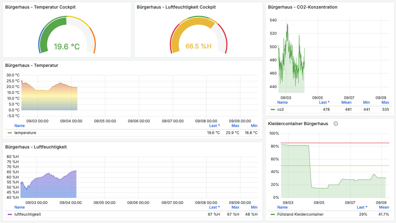
In Marktleuthen, a digital infrastructure is being developed for the intelligent recording and management of bookings for public spaces. This is based on our open Urban Data Space Platform (UDSP), combined with the open-source solution ‘Smart City Booking’ and sensor technology for building monitoring (e.g., CO₂ levels, noise levels, window/door status, and lighting).
Access to the system is managed via Keycloak, with user- and role-based permissions. It can be used by both the local administration and citizens, and provides information through dashboards or via API.
Piloting city / location: Marktleuthen
https://www.hypertegrity.de/
Venus GmbH
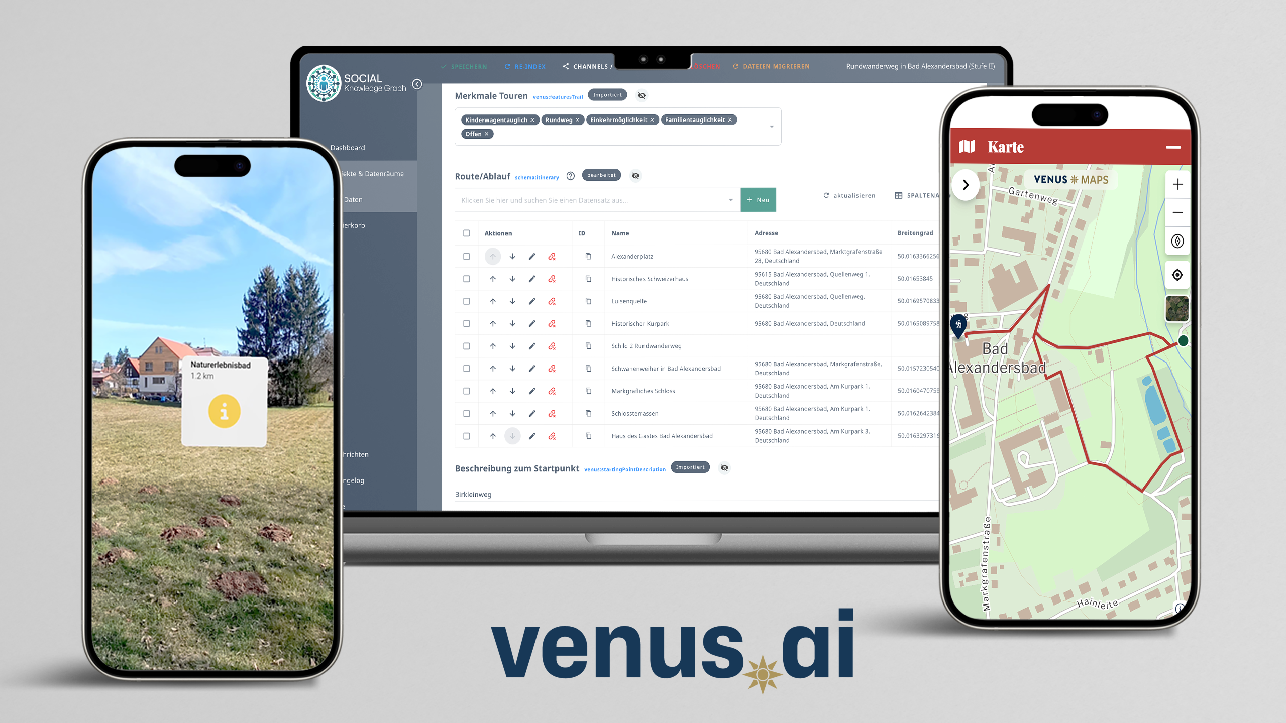
We propose enhancing the region's existing open/shared data with web components that provide AR and geoportal outputs. Along a hiking trail, physical signage will be supplemented with QR codes. When scanned, these codes will display AR directions to continue the trail or reach points of interest and refreshment stops, guiding hikers interactively along the route.
The data is sourced from the existing knowledge graph of TZ Fichtelgebirge, which also documents the locations of each sign. If the route changes—due to tree felling, roadworks, etc.—these updates can be easily made using the dedicated route editor. If QR code signs are affected by the change, a notice on the corresponding URL will inform users of the updated path. Optional warning messages can also be displayed.
Piloting city / location: Bad Alexandersbad
venus.bayern

News & Events
Read the most recent updates and explore the upcoming events.


Would you like to receive project updates?
You're already part of our community!
Welcome to our newsletter community!
Subscribe to our newsletter